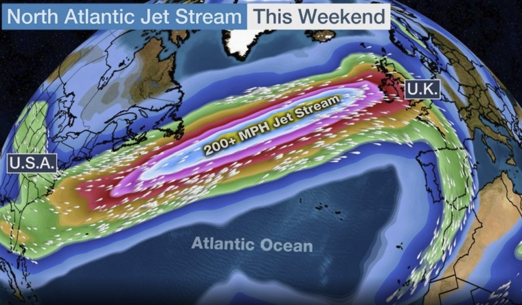
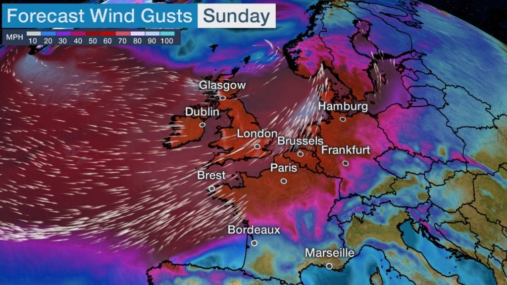
While a deadly storm is currently hitting half of the continental U.S., the North Atlantic jet stream currently drives an intense storm, named Storm Ciara, toward Ireland and the United Kingdom that is forecast to hit Saturday night into Sunday and further spread across other parts of northern and central Europe into Monday.
Storm Ciara will be driven by a jet stream with winds of more than 200 mph over the North Atlantic.
The jet stream is a narrow ribbon of strong winds about 30,000 feet high in the atmosphere and commonly found over the North Pacific Ocean.
It is normally stronger in winter in the Northern hemisphere due to the intensified temperature contrasts between the higher and middle latitudes.

The jet stream helps develop and steer weather conditions where we live on the Earth’s surface and is also where most commercial jets fly.
Wind gusts of 50 to 65 mph are possible in Ireland and the United Kingdom from Storm Ciara.
Exposed locations might have wind gusts over 70 mph.

Northern parts of mainland Europe will have strong winds as well, potentially including parts of northern France, Belgium, The Netherlands, northern Germany and Denmark.
The wet and windy storm could cause tree damage, power outages and disrupt travel.
Huge waves
Huge waves will also propagate toward Ireland, southwestern England and the Bay of Biscay (western France).
Significant wave heights off the coast of Ireland could reach 60 feet.
Coastal flooding and erosion is possible as the pounding surf moves into areas near the coast.
The strong jet stream over the North Atlantic drives a powerful storm into northwestern Europe this weekend with strong winds that could cause damage and knock out power and giant waves up to 60 feet eroding and flooding coastal areas.
No comments:
Post a Comment