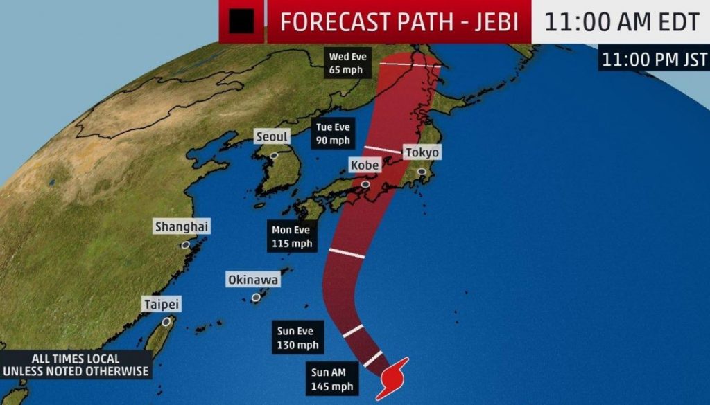
Super Typhoon Jebi – the Earth’s strongest storm of 2018 – continues to roar in the western Pacific Ocean at 170 mph. Although weakening, the dangerous storm is expected to make a direct hit on Japan early next week with winds of 120 mph, gusting to nearly 150 mph – equivalent to a Category 3 hurricane.
Rainfall flooding, high winds, battering waves and coastal flooding are all expected as Jebi pushes ashore Tuesday into Wednesday. Damaging winds and coastal flooding may be the most significant impacts with this storm.
Check out this imagery #Himawari8 captured today of a 4-pointed star-looking cloud feature rotating in the middle of the eye of Super Typhoon #Jebi. The storm is expected to track northwest toward Japan in the coming week. More imagery: https://t.co/wNd7IzB944 pic.twitter.com/OGQMHZzPTz— NOAA Satellites (@NOAASatellites) 31 août 2018
PACIFIC STORM TRACKER | Super Typhoon Jebi is starting to weaken — but bases across Japan are preparing for the worst. https://t.co/wpGmIXuIstpic.twitter.com/vVHMr6BnPJ— Stars and Stripes (@starsandstripes) 1 septembre 2018
Japan has already been hit hard by other tropical systems, historic flooding and a deadly heat wave this year. Jebi would be the seventh named storm to impact Japan this year and comes on the heels of Cimaron, which slammed into Japan late last week.

No comments:
Post a Comment