Are strong and shallow quakes becoming the new normal in the Caribbean?
M6.1 strikes off Cayman Islands just hours after major M7.7 off Jamaica.
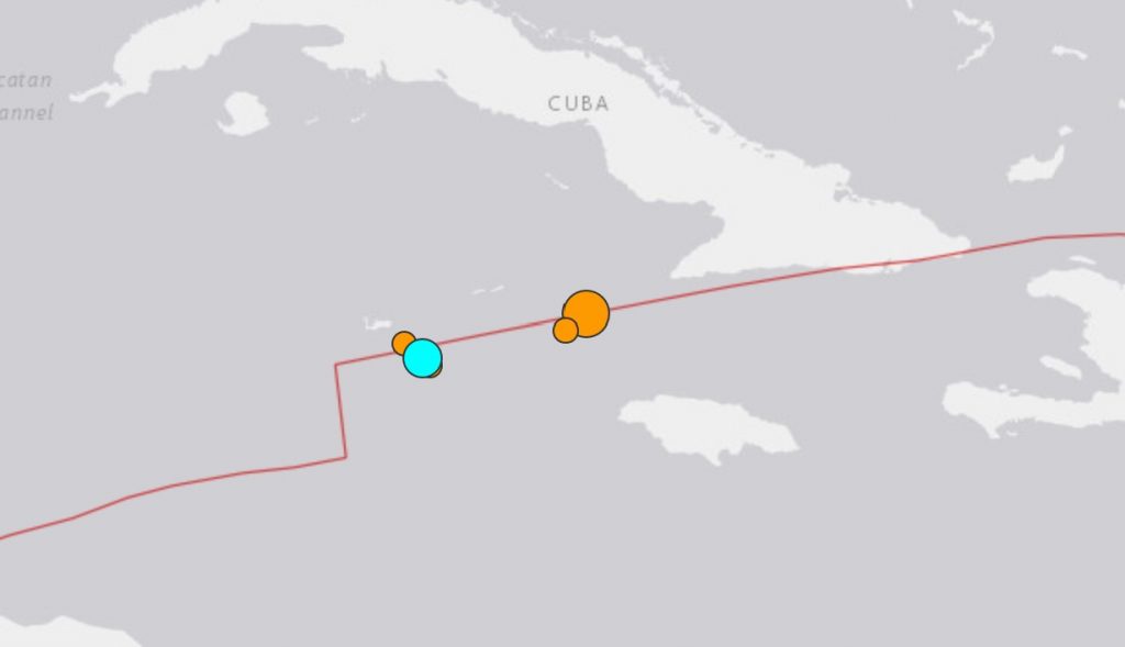
A M6.1 earthquake struck 57km SE of East End, Cayman Islands about three hours after the strongest quake in the Caribbean since 1900, a M7.7, struck between Cuba and Jamaica on January 28, 2020.
As shown on the map below, the two strong quakes hit directly on the plate boundary (red line).
The Caribbean Sea lies over the Caribbean Plate, a section of the earth’s crust bounded by active faults separating it from other tectonic plates.
These other plates include the North American Plate to the north and east and the Pacific Plate to the west.
Relative motions between these plates cause earthquakes at their boundaries. The video below shows the earthquakes that hit the Caribbean between 1918-2019.
Most of the east-west trending boundaries are “strike-slip” or transform faults such that the plates move past each other horizontally. Since they move sideways they do not generally cause earthquakes that move the ocean water above them, though they can trigger landslides that generate tsunamis, such as in Haiti in 2010.
But the boundaries of the Caribbean Plate that run northwest-southeast in Central America and the Leeward Islands are subduction zones, a type of plate boundary that can produce megathrust earthquakes with large vertical motions that can cause devastating tsunamis, such as the pair of devastating Dominican Republic earthquakes in 1946.
No comments:
Post a Comment