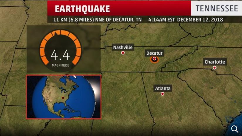
Two earthquakes struck Wednesday morning in eastern Tennessee, rattling people awake across several Southeastern states.
The first one, a preliminary 4.4-magnitude earthquake, occurred at 4:14 a.m. local time. It was the second strongest quake on record in east Tennessee, the local National Weather Service office tweeted, citing the United States Geological Survey, or USGS.
A preliminary 3.3-magnitude quake took place shortly after at 4:27 a.m. local time, the USGS reported.
The temblors hit near Decatur, Tennessee, the agency said.
The earthquakes were felt hundreds of miles away, including in Atlanta, and in the surrounding states of Alabama, Kentucky and the Carolinas.
Residents near the center of the quakes saw photo frames and other items falling over, the Meigs County Sheriff's Department said.
There were no immediate reports of major damage.
The area is part of the Eastern Tennessee Seismic Zone, stretching from northeastern Alabama to southwestern Virginia. It's the second-most active seismic zone in the central and eastern US, behind the New Madrid zone in the Mississippi River region, according to the Seismological Society of America.
An early morning earthquake in east Tennessee Wednesday was widely felt over the Southeast U.S. The magnitude 4.4 quake struck around 4:14 a.m. EST, centered about 7 miles north-northeast of Decatur, Tennessee, in Meigs County, about 55 miles west-southwest of Knoxville. And right across the river from Watts Bar Nuclear Plant
It was followed about 12 minutes later by a magnitude 3.3 aftershock.
According to the U.S. Geological Survey, light shaking was observed over most of the Atlanta metro area, and a number of states from southern Alabama to South Carolina, North Carolina, and Kentucky.
More than 5700 people reported feeling the earthquake on the USGS homepage summary. There were however no immediate reports of damage or injuries.
This quake was one of the strongest on record in east Tennessee, exceeded only by a November 30, 1973 near Maryville, south of Knoxville which lead to minor damage near the epicenter.
The quake appeared to occur along the Eastern Tennessee Seismic Zone, a southwest-to-northeast belt extending from Alabama to far southwest Virginia that is the second-most active quake zone in the central and eastern U.S. behind the more notorious New Madrid zone.
A 2014 USGS study bumped a portion of the ETSZ to a higher risk of earthquakes, though not nearly as high as the New Madrid zone in the western part of Tennessee and other adjacent states.

No comments:
Post a Comment