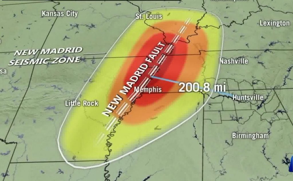
Today, the New Madrid Zone was hit by two small earthquakes: M2.8 and M3.1 in New Madrid County, Missouri.

M3.1 Earthquake Near Lilbourne, Missouri
An earthquake shook portions of New Madrid County, Missouri on Friday, September 27 at around 3:47 a.m.
M2.8 Earthquake Near East Prairie, Missouri
A magnitude 2.8 earthquake shook parts of southeast Missouri, around 11:42 p.m., September 26.
It was centered 3.5 miles northeast of Pinhook, Missouri
The New Madrid Seismic Zone is the most active earthquake zone east of the Rocky Mountains and spans southeastern Missouri, northeastern Arkansas, western Tennessee, western Kentucky, and southern Illinois.
A high-resolution map of surface displacements indicates that the 2017 Chiapas earthquake caused substantial creep along a segment of the San Andreas Fault.
They are both separated by 3,000 kilometers (1,864 miles).
In the traditional model of the earthquake cycle, a seismic event occurs when an active fault abruptly releases strain that has built up over time.
About 20 years ago, however, seismologists began finding that some faults, or sections of faults, can experience slow earthquakes — a gradual type of aseismic slip, or “creep,” that can last for months.
Because both types of events release pent-up energy, determining the proportion of seismic versus aseismic slip along active faults is crucial for estimating their potential hazard.
Although conventional interpretations predict that aseismic slip should occur at a roughly constant rate, geodetic observations have shown that at some locations fault creep is anything but steady.
Measurements along the southern San Andreas Fault in California, one of the most studied examples of a creeping fault, have shown that this section often experiences bouts of accelerated creep and that these events can be spontaneous or triggered by seismic events.
But the underlying conditions and mechanisms that cause slow slip are still poorly understood.
Now, a new report details observations of a slow-slip event that occurred along the southern San Andreas Fault following the magnitude 8.3 earthquake that hit offshore Chiapas, Mexico, in September 2017.
The team combined the results of field mapping with creepmeter and Sentinel-1 interferometric synthetic aperture radar observations to create a high-resolution map of surface displacements near the Salton Sea.
The researchers then entered the results into numerical models to constrain the crustal properties that could generate the observed behavior.
The results indicate that surface slip along the 40-kilometer-long section between Bombay Beach and the Mecca Hills accelerated within minutes of the Chiapas earthquake and continued for more than a year.
The event resulted in total surface offsets that averaged 5-10 millimeters, comparable to the slow slip triggered by the 2010 magnitude 7.2 El Mayor-Cucapah (Baja) earthquake, even though the stress changes along the southern San Andreas due to the Chiapas earthquake were several orders of magnitude lower.
The findings offer compelling evidence that the Chiapas earthquake triggered the 2017 slow-slip event along the southern San Andreas Fault.
The authors also concluded that although shallow creep near the Salton Sea is roughly constant on decadal timescales, it can vary significantly over shorter periods of time.
Can you imagine that? It seems so complex to me. A strong earthquake that triggers a 1-year-long earthquake swarm 1,864 miles away on one of the most dangerous faults California. Yes, such stories are kind of scary.
No comments:
Post a Comment